RadxQpe expanded
From Lrose Wiki
Overview
The goal of RadxQpe is to provide the best two-dimensional estimate of rainfall at ground level. To do so, RadxQpe must account for areas of weak signal, elevated terrain, and the height of the radar beam. This page will walk through how the parameter file and application handle these factors to produce the end result.
Elevated Terrain
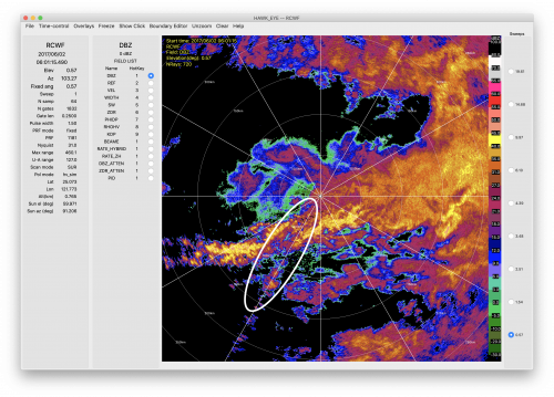
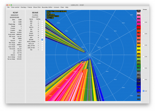
In certain regions, mountain ranges block radar beams at lower elevation angles, as shown in the example of a 0.5º elevation sweep from northern Taiwan below. The white oval highlights weak reflectivity values in the middle of the east-west line of heavy reflectivity values. The region of weak reflectivity corresponds to beam blockage by Taiwan's Central Mountain Range, as shown in the image of beam blockage (represented as a fractional value in the right image.
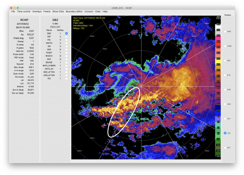
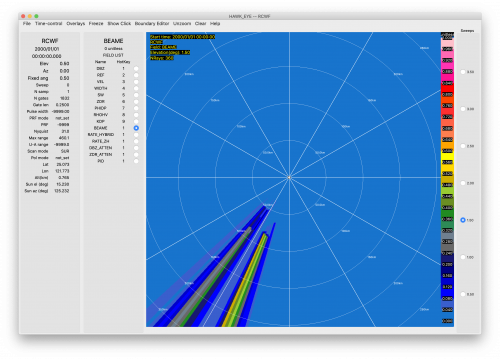
However, radars usually scan three-dimensional volumes and at an elevation angle of 1.5º, the band of intense reflectivity values in the oval is no longer discontinuous and the beam blockage is far less. RadxQpe takes advantage of the three-dimensional radar volume to look at different elevation angles in regions where terrain exists to fill in the gaps where low-level radar beams are blocked.


